


GPSMAP 67 - handheld GPS - 010-02813-01 - Garmin
- Brand: Garmin
- Product Code: 010-02813-01
- Availability: In Stock
- $621.62
- Ex Tax: $621.62
Qty
GPSMAP 67 - handheld GPS - 010-02813-01 - Garmin
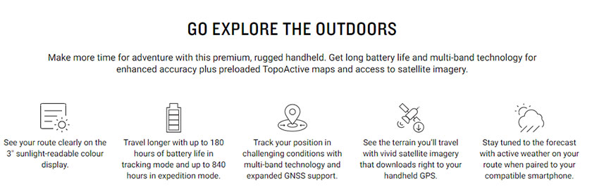
You Love exploring the outdoors. you need a handled GPS with long battery life and our most accurate tracking - even in the most challenging conditions. This is the one


IN THE BOX:
- GPSMAP 67
- Type A to Type C USB cable
- Carabiner clip
- Documentation
IN THE BOX:
- GPSMAP 67
- Type A to Type C USB cable
- Carabiner clip
- Documentation
| InReach Features | |
| InReach Remote Compatible | Yes |
| Physical & Performance | |
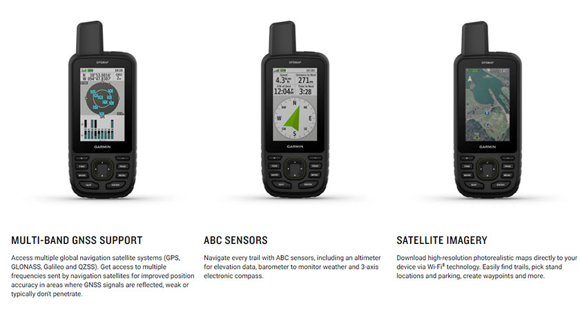
| Glonass | Yes |
| GENERAL | |
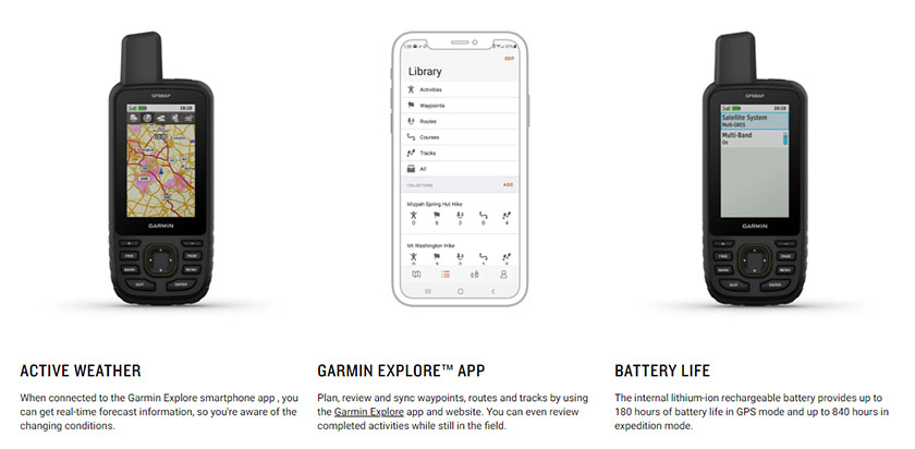
| Battery life | Up to 180 hours in default mode // Up to 840 hours in expedition mode |
| Battery type | Rechargeable, internal lithium-ion |
| DIMENSION | 6.2 x 16.3 x 3.5 cm (2.5″ x 6.4″ x 1.4″) |
| Display resolution | 240 x 400 pixels |
| Display size | 3.8 x 6.3 cm (1.5″W x 2.5″H ); 7.6 cm diag (3″) |
| Display type | Transflective color TFT |
| Interface | USB-C |
| Memory/history | 16 GB (user space varies based on included mapping) |
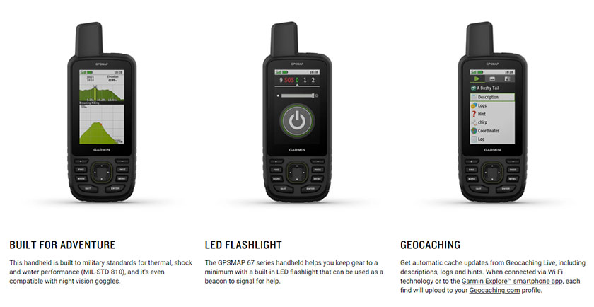
| MIL-STD-810 | Yes (thermal, shock, water); bare unit only |
| Water rating | IPX7 |
| Weight , | 230 g with batteries |
| Sensors | |
| Barometric altimeter | Yes |
| BEIDOU | Yes |
| Compass | Yes |
| Galileo | Yes |
| GPS | Yes |
| GPS Compass | Yes, (WHILE MOVING) |
| HIGH-SENSITIVITY RECEIVER | Yes |
| IRNSS | Yes |
| MULTI-BAND FREQUENCY | Yes |
| QZSS | Yes |
| Daily Smart Features | |
| ACTIVE WEATHER | Yes |
| Compatible with Garmin Connect™ Mobile | Yes |
| Connect IQ™ | Yes, (DOWNLOADABLE WATCH FACES, DATA FIELDS, WIDGETS, AND APPS) |
| SMART NOTIFICATIONS ON HANDHELD | Yes |
| VIRB® Camera Remote | Yes |
| Maps & Memory | |
| Ability to add maps | Yes |
| ACTIVITIES | Yes |
| Basemap | Yes |
| COURSES | 250, 200-course points per course |
| DISPLAYS NATIONAL, STATE/ LOCAL PARKS, FORESTS, WILDERNESS AREAS | Yes, |
| INCLUDES DETAILED HYDROGRAPHIC FEATURES | Yes, (COASTLINES, LAKE/RIVER SHORELINES, WETLANDS, AND PERENNIAL AND SEASONAL STREAMS) |
| INCLUDES SEARCHABLE POINTS OF INTERESTS | Yes, (PARKS, CAMPGROUNDS, SCENIC LOOKOUTS AND PICNIC SITES) |
| MAP SEGMENTS | 15,000 |
| NAVIGATION ROUTES | 250, 250 points per route; 50 points auto routing |
| NAVIGATION TRACK LOG | 20,000 points, 250 saved gpx tracks, 300 saved fit activities |
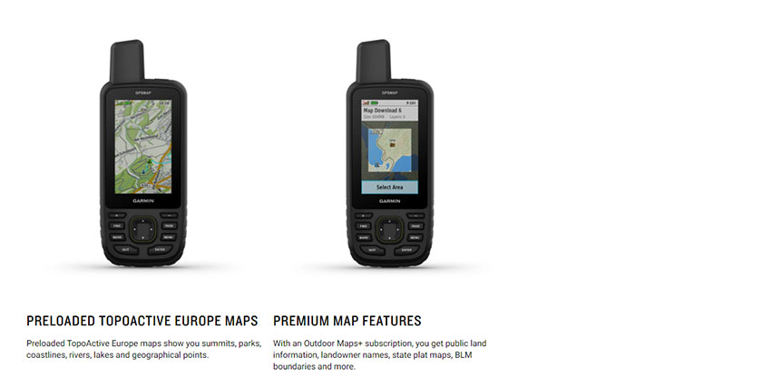
| Preloaded maps | Yes (TopoActive Europe; routable) |
| SATELLITE IMAGERY | Yes (direct to device) |
| Storage and Power Capacity | Yes (32 GB max microSD™ card) |
| Tracks | 250 |
| Waypoints/favourites/locations | 10,000 |
| Safety and tracking features | |
| LiveTrack | Yes |
| Connections | |
| CONNECTIONS WIRELESS CONNECTIVITY | Yes (Wi-Fi®, Bluetooth®, ANT+®) |
| Outdoor Recreation Features | |
| Area calculation | Yes |
| Hunt/fish calendar | Yes |
| LED BEACON FLASHLIGHT | Yes |
| Point-to-point navigation | Yes |
| Sun and moon information | Yes |
| TracBack® | Yes |
| XERO™ Locations | Yes |
| OUTDOOR APPLICATIONS | |
| COMPATIBLE WITH GARMIN EXPLORE™ APP | Yes |
| Garmin Explore Website Compatible | Yes |
| Outdoor Features | |
| Automatic routing (turn by turn routing on roads) | Yes, FOR OUTDOOR ACTIVITIES |
| Custom maps compatible | Yes (500 custom map tiles) |
| Geocaching-friendly | Yes (Geocache Live) |
| Picture viewer | Yes |
Tags: GPS, handheld gps, Navigation, Satellite, Communicator,