- AUTOMOTIVE
- BOATING
-
DIVING
- Bags
- BCDS
- Belts
- Chargers & Batteries
- Cylinders
- Diving Sets
- DPV Scooters
- Dry Boxes
- Fins
- General Accessories
- Instruments
- Knives
- Lifting Bag
- Masks
- Neoprene Accessories
- Regulators & Octopus
- Sets and Combo
- Signaling Buoys
- Snorkels
- Speargun Accessories
- Spearguns
- Suits
- Torches
- Underwater Cameras & Parts
- Underwater Communication Systems
- Watches
- ENGINE
- FISHING
- GARMIN
- INDUSTRIALS
- SOLAR ENERGY
- SPORTS
- SPECIAL OFFERS
- CONTACT US


Oregon 700 - 010-01672-01 - Garmin
- Brand: Garmin
- Product Code: 010-01672-01
- Availability: Out Of Stock
- $441.44
- Ex Tax: $441.44
Rugged GPS/GLONASS Handheld with Built-in Wi-Fi® and more
- High-sensitivity dual GPS and GLONASS satellite reception for better performance in challenging environments than GPS alone
- Enhanced antenna enables better reception and performance; 3-axis compass with accelerometer and barometric altimeter sensors
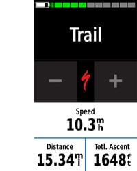
- 3-inch sunlight-readable touchscreen with dual orientation (landscape or portrait view)
- Expanded wireless connectivity (Wi-Fi, Bluetooth®, ANT+® capable); supports Active Weather and Geocaching Live
- Bluetooth®-enabled Smart Notifications1 and automatic uploads to Garmin Connect™ online community
- 1-year BirdsEye Satellite Imagery subscription included

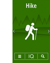
Thanks to an enhanced redesigned antenna for better satellite reception, the Oregon 700 GPS and GLONASS handheld puts even more of the great outdoors at your fingertips. Whether you’re hiking, biking, geocaching, climbing, kayaking, trail riding or whatever, this rugged navigator is ready for anything. It features multilink wireless connectivity (Wi-Fi, Bluetooth and ANT+), Active Weather support with animated radar overlays, a 1-year BirdsEye Satellite Imagery subscription and a built-in 3-axis compass with barometric altimeter.
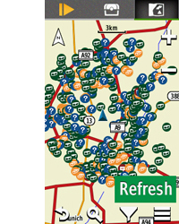
Find Fun with Geocaching.com
The wireless connectivity to Geocaching.com on your Oregon makes it easier than ever to enjoy a superior geocaching experience. You can set your device to automatically stay up to date with all the latest caches. No more manual entry of coordinates or printing out cache details on paper.
More Connectivity, Less Complexity1
The expanded wireless capabilities of Oregon 700 make it easier than ever to update software, check the weather radar2 and upload adventures to ourGarmin Connect online community. You can even share LiveTrack location data or geocache discoveries via WiFi or smartphone. Smart Notifications via Bluetooth connectivity with a compatible smartphone let you receive emails, texts and alerts right on your device. So you can see what’s going on while you’re getting away from it all.
Navigate Your Way
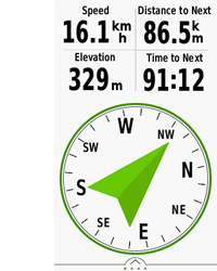
The Oregon 700 handheld provides comprehensive navigation and tracking to guide you on and off the beaten path, using GPS and GLONASS plus ABC (altimeter, barometer and compass) sensor capabilities. The built-in altimeter provides elevation data to accurately monitor ascent and descent, while the barometer can be used to predict weather changes by showing short-term trends in air pressure. The 3-axis electronic compass keeps your bearing, whether you’re moving or not. There’s also a TracBack® feature on Oregon 700 to help you navigate back to your starting point the same way you came. You can also mark locations, such as your campsite, vehicle or other points of interest, to which you'd like return navigation.
Enjoy the View on a Vivid Display
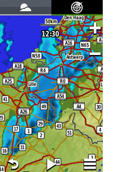
The Oregon 700 handheld features a bright, sunlight-readable 3-inch colour touchscreen display with dual orientation for landscape or portrait views. It easily supports multiple mapping options such asBlueChart® g2 HD for water navigation or City Navigator® for turn-by-turn driving directions. Durable and water-rated to IPX7, the Oregon series is built to keep delivering vital mapping and tracking data, no matter what the elements throw at you. Plus, you can even customise your Oregon’s display with free downloads from the Garmin Connect IQ™ online store3.
Plan Your Next Trip
Take charge of your next adventure with BaseCamp™, software that lets you view and organise maps, waypoints, routes and tracks. This free trip-planning software even allows you to create Garmin Adventuresthat you can share with friends, family or fellow explorers online. BaseCamp displays on your computer screen any topographic map data stored on the device, including contour lines and elevation profiles. It also can transfer an almost unlimited amount of satellite images to your device using the included BirdsEye Satellite Imagery subscription.
1When paired with a compatible smartphone. See garmin.com/ble for compatibility.
2Active Weather is available in the UK, Ireland, Portugal, Spain, France, Germany, Belgium, Netherlands, Luxembourg, Switzerland, Denmark, Norway, Sweden, Finland, Austria and Slovenia with partial coverage in Northern Italy.
3Apps, widgets and data fields will be introduced when they become available; not all products may be available all the time. Please check ourwebsite for current inventory of Connect IQ products.
The Bluetooth® word mark and logos are registered trademarks owned by Bluetooth SIG, Inc. Wi-Fi® is a registered trademark of the Wi-Fi Alliance.
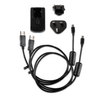
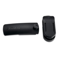
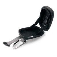
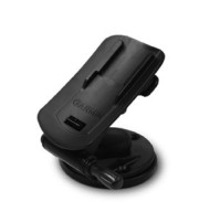
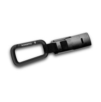
IN THE BOX:
- Oregon 700
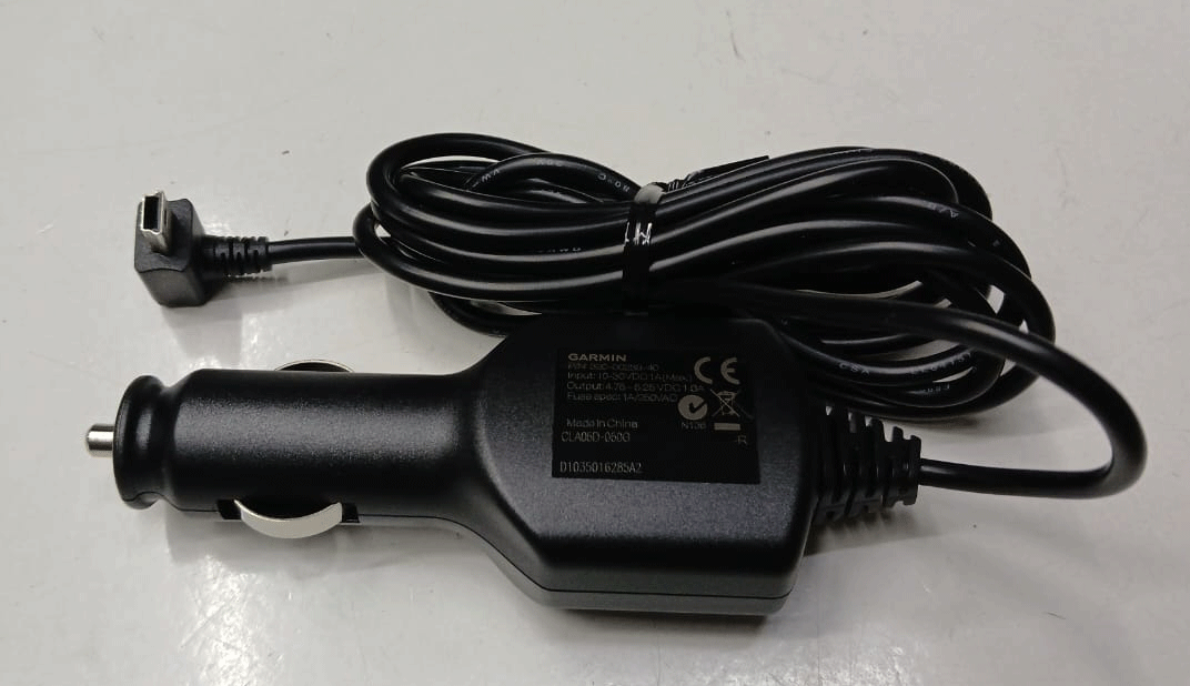
- USB cable
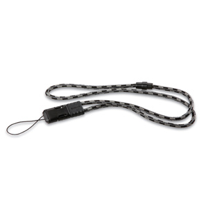
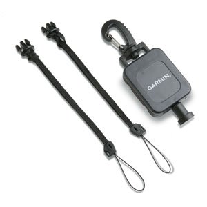
- Carabiner clip
- Documentation
| Physical & Performance | |
| Battery: | 2 AA batteries (not included); NiMH or Lithium recommended, rechargeable NiMH pack (optional) |
| Camera | No |
| Weight: | 209.8 g with batteries |
| Physical dimensions | 6.1 x 11.4 x 3.3 cm |
| Display size, WxH | 3.8 x 6.3 cm; 3" diag (7.6 cm) |
| Display resolution, WxH | 240 x 400 pixels |
| Touchscreen | YES |
| Battery life | Up to 16 hours |
| Water rating | IPX7 |
| High-sensitivity receiver | YES |
| Barometric altimeter | YES |
| Electronic Compass | Yes (tilt-compensated 3-axis) |
| Display type | Transflective colour TFT touchscreen |
| unit-to-unit transfer | Yes (plus images and custom maps), (shares data wirelessly with similar units). |
| Interface | high-speed USB and NMEA 0183 compatible |
| Garmin Connect® | |
| Garmin Connect™ compatible | YES, online community where you analyze, categorize and share data. |
| Maps & Memory | |
| Ability to add maps | YES |
| Accepts data cards | microSD™ card up to 32 GB (not included) |
| Basemap | YES |
| Built-in memory | 1.7 GB |
| Custom POIs (ability to add additional points of interest) | YES |
| Preloaded maps | No |
| Routes | 250 |
| Track log | 20,000 points, 250 saved tracks |
| Waypoints/favorites/locations | 10,000 |
| Outdoor Features | |
| Area calculation | YES |
| Automatic routing (turn by turn routing on roads) | Yes (with optional mapping for detailed roads) |
| Custom maps compatible | YES |
| Geocaching-friendly | Yes (Paperless) |
| Picture viewer | YES |
| Tide Tables | Yes (with optional Bluechart) |
| Hunt/fish calendar | YES |
| Sun and moon information | YES |
| Additional | |
| Additional | Wireless compatible: Yes (Wi-Fi, Bluetooth and ANT+) Map segments: 15,000 Active Weather: Yes Connect IQ compatible: Yes (widgets, apps and data fields) |


Tags: Oregon, GPS, Handheld GPS,
Azzi Sport Copyright @2023
Developed by Software Senior