- AUTOMOTIVE
- BOATING
-
DIVING
- Bags
- BCDS
- Belts
- Chargers & Batteries
- Cylinders
- Diving Sets
- DPV Scooters
- Dry Boxes
- Fins
- General Accessories
- Instruments
- Knives
- Lifting Bag
- Masks
- Neoprene Accessories
- Regulators & Octopus
- Sets and Combo
- Signaling Buoys
- Snorkels
- Speargun Accessories
- Spearguns
- Suits
- Torches
- Underwater Cameras & Parts
- Underwater Communication Systems
- Watches
- ENGINE
- FISHING
- GARMIN
- INDUSTRIALS
- SOLAR ENERGY
- SPORTS
- SPECIAL OFFERS
- CONTACT US

VEU723L - Micro SD™/SD™ Card For Southern Europe - 010-C1157-00 - Garmin
- Brand: Garmin
- Product Code: 010-C1157-00
- Availability: In Stock
- $441.44
- Ex Tax: $441.44
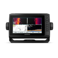
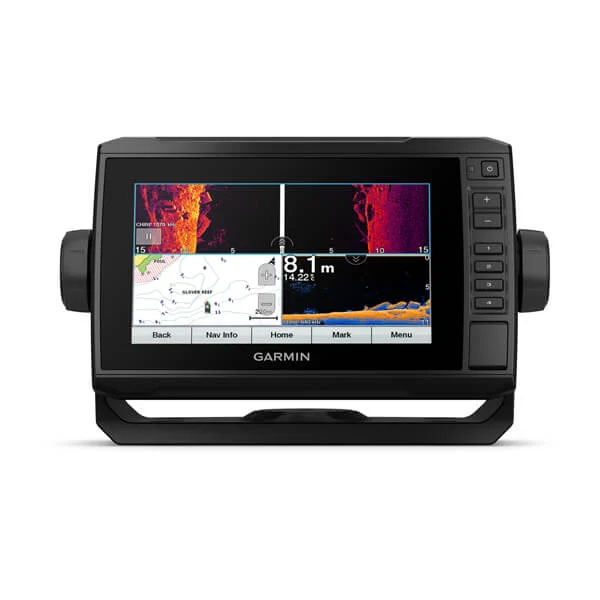
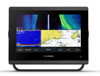
Premier Coastal Charts
- Industry-leading coverage, clarity and detail with updated coastal charts that feature integrated Garmin and Navionics® content
- Auto Guidance¹ technology quickly calculates a suggested route by using your desired depth and overhead clearance
- Includes Depth Range Shading for up to 10 depth ranges, enabling you to view your target depth at a glance
- Up to 1’ contours provide a more accurate depiction of the bottom structure for improved fishing charts
- To give a clear picture of shallow waters to avoid, the Shallow Water Shading allows for shading at a user-defined depth
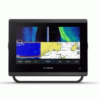
Experience unparalleled coverage and brilliant detail when you’re on the water. BlueChart g3 Vision coastal charts provide industry-leading coverage, clarity and detail with integrated Garmin and Navionics content.
Auto Guidance
Whether you are fishing or cruising, select a spot, and get a route showing you the general path and nearby obstructions at a safe depth.
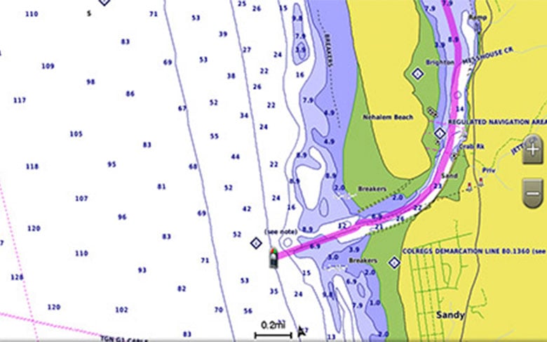
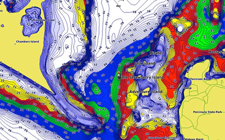
Depth Range Shading
This feature displays high-resolution Depth Range Shading for up to 10 depth ranges so you can view your designated target depth.
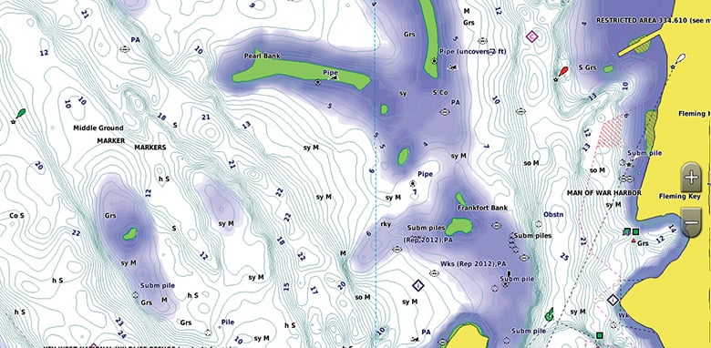
Shallow Water Shading
To give a clear picture of shallow waters to avoid, this feature allows for shading at a user-defined depth.
Detailed Contours
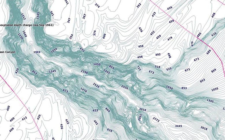
BlueChart g3 Vision charts feature 1’ contours that provide a more accurate depiction of bottom structure for improved fishing charts and enhanced detail in swamps, canals and port plans.
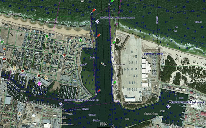
High-resolution Satellite Imagery
High-resolution satellite imagery with navigational charts overlaid gives you a realistic view of your surroundings. It’s our most realistic charting display in a chartplotter — ideal for entering unfamiliar harbors or ports.
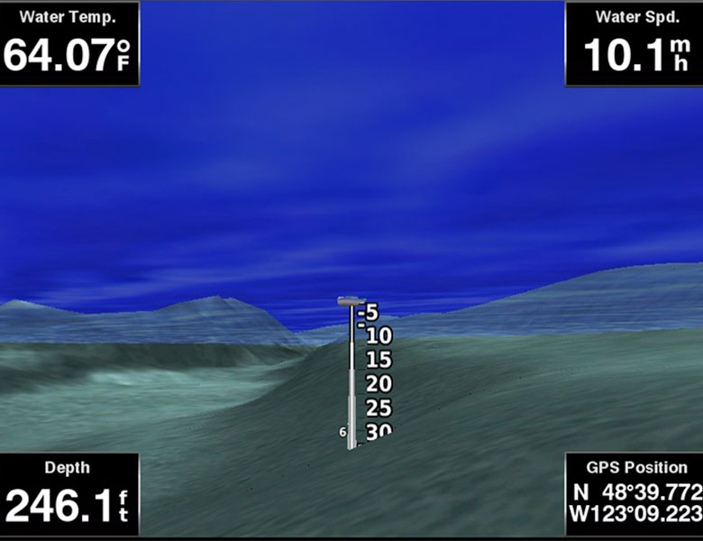
FishEye View
This underwater perspective shows 3-D representation of bottom and contours as seen from below the waterline. Interface with sonar data for a customized view.
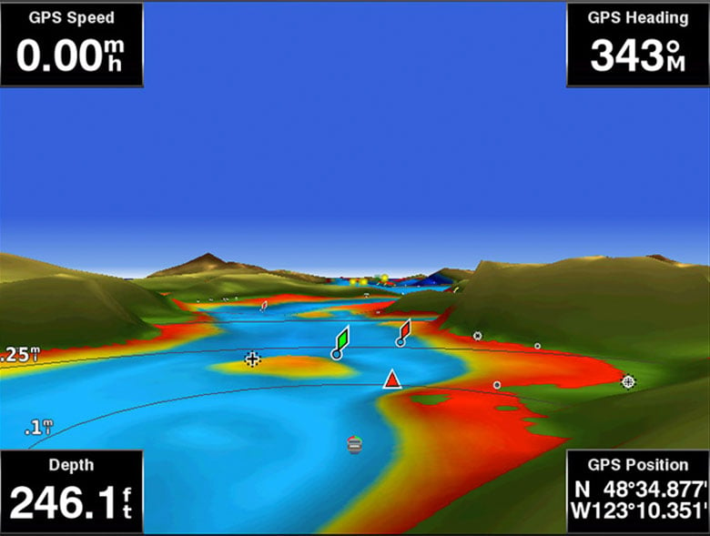
MarinerEye View
This view provides a 3-D representation of the surrounding area both above and below the waterline.
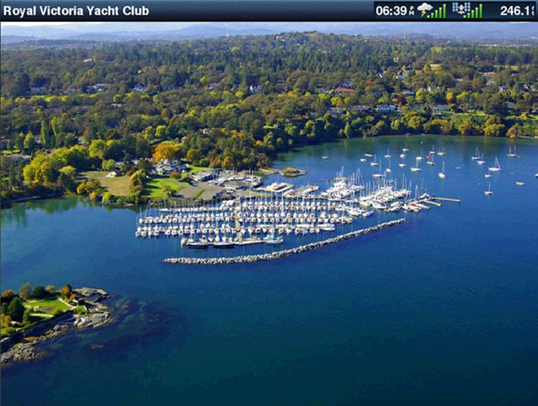
Aerial Photography
Crystal-clear aerial photography shows exceptional detail of many ports, harbors and marinas and is ideal when entering unfamiliar ports.
Download Requirements
File Information
The file size of this download and space required on your microSD™/SD™ card is 0 MB. It is not recommended that this download be loaded directly to your device. It only can be loaded to a prepared or blank microSD/SD card (recycled microSD cards may be used to program map data).
Up to 500 MB of additional space may be required for software updates.
BlueChart Feature Comparison
Feature | BlueChart g3 Vision | BlueChart g3 |
|---|---|---|
| Integrated Garmin and Navionics content | • | • |
| Auto Guidance¹ technology | • | • |
| Depth range shading | • | • |
| Up to 1' contours | • | • |
| Shallow water shading | • | • |
| Raster cartography² | • | • |
| High-resolution relief shading | • | |
| Unique 3-D views | • | |
| High-resolution satellite imagery | • | |
| Aerial photos | • |

Detailed offshore coastal coverage of the Mediterranean Sea, the Black Sea and the Iberian Peninsula. Coverage features the Strait of Gibraltar, the Balearic Islands, the French Riviera, Corsica, Sardinia, Sicily, the Adriatic Sea, the Greek Islands, the Aegean Sea, the Dardanelles and Bosporus straits, the Sea of Azov, the Dneiper River to the Belarus/Ukraine border, the Sea of Marmara, Cyprus, the Suez Canal, Tripoli and Algiers Harbors, the Gulfs of Gabès and Tunisia, and selected inland waters. Also details the Atlantic side of the Iberian Peninsula from the Canary Islands to the Bay of Biscay including the Gulf of Cadiz, the Portugese coast, the Gulf of Gascogne, and the Madeira and Azores Islands.
Tags: Blue Chart, Premium, High, Resolution, Sea, Floor,
Azzi Sport Copyright @2023
Developed by Software Senior